The river known today as the Beas derives its modern name from Rishi Vyāsa (Ved Vyāsa), the sage traditionally credited with compiling the Vedas and composing the Mahābhārata. In the Ṛg Veda, however, this river appears as Vipāśā, a term often interpreted as “the one who releases from bondage,” derived from vi (apart) and pāśa (fetter or bond). Over the centuries, Vipāśā gradually transformed into Vyāsa and then into Beas, reflecting both linguistic evolution and enduring cultural veneration for the sage.
To the ancient Greeks, the river was known as the Hyphasis, marking the easternmost limit of Alexander the Great’s campaign in 326 BCE, where his troops famously refused further advance into the Indian subcontinent.
Origins
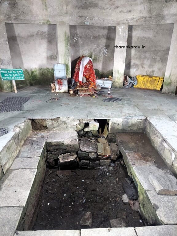
A pilgrimage site associated with Rishi Vyāsa exists near the Rohtang Pass, known as Beas Rikhi Sthal. Here, a spring emerging from a rock forms a small stream revered locally. This watercourse, popularly assumed to be the source of the Beas, is in fact not the river’s true point of origin.
This stream—called the Beas Rikhi Nala—is fed by the Rahni and Sagu rivulets in the Rohtang region. As it descends toward Marhi, it enlarges into a modest but persistent flow, retaining the same local name.
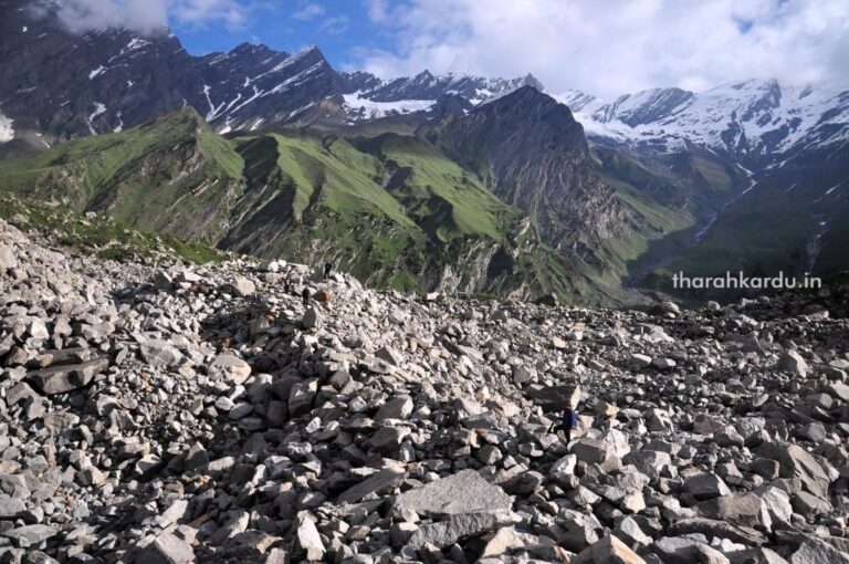
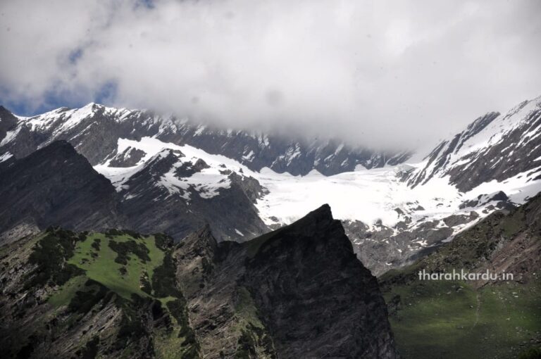
The true hydrological origin of the Beas lies farther west at Beas Kund (elevation 3,720 m / 12,200 ft), a high-altitude glacial lake situated at the junction of the Dhauladhar and Pir Panjal ranges. Beas Kund is traditionally regarded as the bathing place of Rishi Vyāsa.
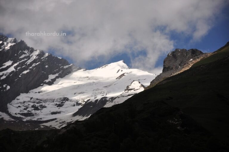
The lake is fed by an interconnected system of glaciers and icefields positioned on the Pir Panjal side, locally described as the “Beas kundé rī dhar”. This section lies between Mt. Sheti Dhar (5,243 m / 17,200 ft) and Friendship Peak (5,288 m / 17,353 ft).
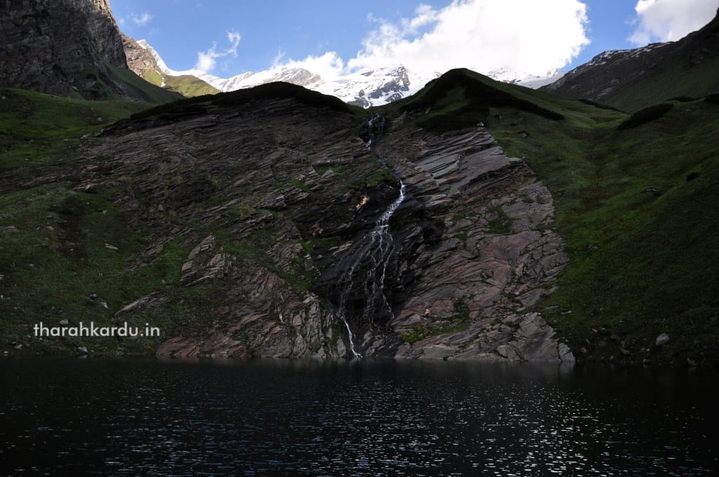
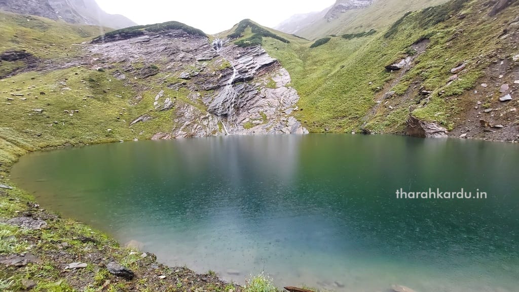
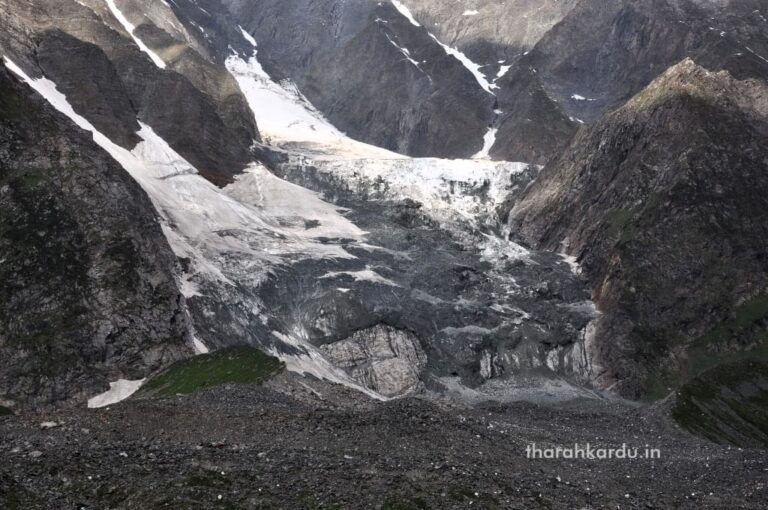
The initial stream emerging from the sacred lake forms the nascent Beas and is venerated locally as a Jogni, worshipped under the name Vyās Kundnī. This early channel is sustained by meltwater from two principal glaciers. The first descends from the slopes beneath Ladakhi Peak (5,547 m / 18,200 ft). The second—and more substantial—is the Beas Kund Glacier, with an average elevation of approximately 4,300 m (14,107 ft), situated westward below Hanuman Tibba (5,930 m / 19,450 ft).
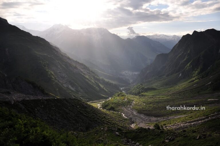
Early Course: From Beas Kund to Kullu
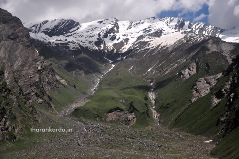
The principal stream emerging from Beas Kund is joined by numerous smaller rivulets before flowing down to Dhundhi and Solang, where it merges with the Dhundhi and Seri Nallahs. Until Palchan, this segment is called the Solang Nala. At Palchan, it meets the Beas Rikhi stream descending from Rohtang, and from this confluence, the Beas River proper begins. A smaller tributary, the Sarehi Nala, also joins here.
Further downstream, near Bahang and Goshal, the Beas receives the Rhindi Nala, and beyond Manali, it is joined by the Manalsu, Fozal, and Sarwari streams as it flows through the fertile Kullu Valley. At Bhuntar, it meets its major tributary, the Parvati River, and near Aut, it is joined by the Tirthan River.
Through the Valleys and Plains
Leaving the Kullu Valley, the Beas reaches Pandoh, where the Pandoh Dam diverts much of its water into the Sutlej basin for hydroelectric generation. A few kilometres before Mandi, it receives the Uhl River. From here, it traverses Mandi district, entering Kangra near Sandhol, flowing past Harsipattan, Jai Singhpur, Lambagaon, Nadaun (Hamirpur district), Dehra Gopipur, and Dadasibba, before reaching Pong, where it forms the vast Maharana Pratap Sagar reservoir.
Numerous streams of the Dhauladhar Range—including the Binwa, Neugal, Nyund, Gaj, Bhated, Manuni, Awa, Iku, and Manjhi—empty into the Beas along this stretch.
Confluence and Continuation
Beyond Pong/Reh, the river divides into three channels that reunite near Mirthal in Punjab. Entering the plains through Indora (Kangra), the Beas skirts the Shivalik Hills near Hoshiarpur, turning sharply north to form the boundary with Kangra before bending south again to separate Gurdaspur and Hoshiarpur. It briefly touches Jalandhar district, then delineates the boundary between Amritsar and Kapurthala, before finally merging with the Sutlej River at Harike Pattan.
After this confluence, the Sutlej flows into Pakistani Punjab, where it joins the Chenab at Uch to form the Panjnad, which ultimately merges with the Indus River at Mithankot—thus linking the sacred Vipasha of the Himalayas to the mighty Indus system.